Altrincham Circular Walk supported by Home Instead
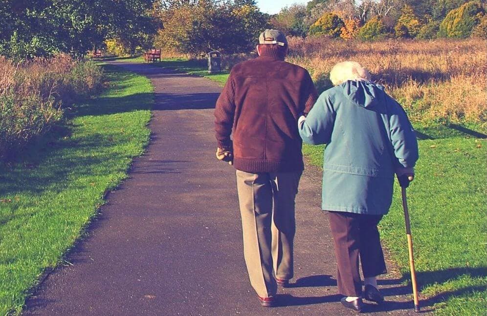
Even a 60-minute walk at a moderate pace, with a 10min quicker pace or steeper climb to push your heart rate a little, can help improve balance, coordination, brain function, energy levels, sleep, and help you keep your weight under control.
Take a look at the Mid Cheshire by train “Altrincham Circular walk” to get you started.
Altrincham Circular walk
This walk starts from the Altrincham Interchange.
DISTANCE: Approximately 6 miles (9 1/2 kilometres) Allow approximately 2 1/4 hours
MAP: OS Explorer Map (1:25 000) Sheet 268 Wilmslow, Macclesfield and Congleton
GROUND CONDITIONS: The walk is mostly on paths with good drainage, but walking boots are recommended as parts of the canal tow path can be very muddy
STILES: One KISSING GATES: One
THE ROUTE
1. Exit Altrincham Interchange from platform one and turn left around the bus stands and then proceed on to Stamford New Road. Turn left and at the traffic lights cross to the right and enter Cross Street. Where the street curves to the left, carry straight on to the pedestrianised section and at the junction turn left and proceed to the end of the pedestrian precinct.
2. Turn right at Regent Road, cross at the zebra crossing and then turn left into New Street and follow this to the end. Turn right into The Downs and almost immediately take the right fork into Woodville Road. After about 100 yards turn left into Bowdon Road.
3. At its end turn right into St Margaret’s Road. Cross to the far side (here there is a footpath that goes into Devisdale which is worth exploring) and continue in the same direction until the main road (A56) to Manchester is met, with St Margaret’s Church opposite. It is necessary to cross this road, but care is needed as it is a busy road.
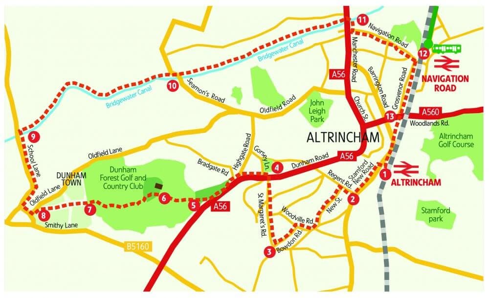
4. When the road has been crossed turn left and proceed. Shortly three roads will be crossed, Gorsey Lane, Highgate Road and Bradgate Road. As Bradgate Road is crossed a footpath can be seen signposted to ‘Dunham Town’. Take this path.
5. After a few yards take the right fork and after a while the footpath improves and effectively becomes a surfaced track. Continue in the same direction and shortly it will be observed that there is a golf course on both sides.
6. When the track leaves the wooded area follow it across the golf course fairway, bearing left, and taking care of flying golf balls coming from the right. Shortly after another wood is entered there is a depot for golf course workers on the right. Bear left here and almost immediately after this take the signed footpath on the right. At the end of this wood, further fairways are encountered. There are metal oblong warning signs, and these give the direction of travel, but again beware of flying golf balls!
7. At the end of this section a gate in the hedge will be observed. Go through this and then immediately turn right and follow this path through two fields.
8. At the end turn left onto Oldfield Lane and after about 60 yards there is a footpath on the right over a stile. Follow this until School Lane is met. Turn right here, past the old Post Office. Proceed past the Axe and Cleaver public house and Dunham Village Hall once a school.
9. Immediately after this the road crosses the Bridgewater Canal. Care is needed as the road is single track here with no footpath. As soon as the bridge has been crossed turn right into the footpath and then turn left onto the bank of the canal.
10. Follow the canal and in just under a mile a road overbridge is met, with a pub (Bay Malton) on the left. Continue to follow the canal and in about the same distance another road overbridge is met. To return to Altrincham leave the canal at this point, but to continue to Timperley stay on the canal and follow the instructions for the next walk.
10. Follow the canal and in just under a mile a road overbridge is met, with a pub (Bay Malton) on the left. Continue to follow the canal and in about the same distance another road overbridge is met. To return to Altrincham leave the canal at this point, but to continue to Timperley stay on the canal and follow the instructions for the next walk.
11.The exit from the canal is a few yards past the bridge. Turn left to the main road and then turn left back over the canal and left again at the Navigation public house into Navigation Road. Follow this until Navigation Road Station is met.
12. From Navigation Road Station either the tram can be caught from the nearside platform or the train from the far platform. This avoids the last three quarters of a mile walk to Altrincham Interchange.
13. Or to walk back to Altrincham, just before the level crossing barriers cross to the right and enter Grosvenor Road. Follow this until it meets Barrington Road at the Barrington Hotel. Keep on the left and walk back to the station.
For further information on exploring Mid Cheshire by train including downloadable copies and larger print versions of the above walk visit www.midcheshirerail.org.uk
Areas We Serve
Wythenshawe, Woodhouse Park, Benchill, Sharston, Northenden, Moss Nook, Peel Hall, Baguley
Brooklands, Sale, Ashton upon Mersey, Altrincham, Bowdon, Hale, Broadheath, Timperley
M22 0, M22 1, M22 4, M22 5, M22 8, M22 9, M23 0, M23 1, M23 2, M23 9, M33 1, M33 2, M33 3, M33 4, M33 5, M33 6, M33 7, M90 1, M90 2, M90 3, M90 4, M90 5, WA14 1 ,WA14 2, WA14 3, WA14 4, WA14 5, WA15 0, WA15 6, WA15 7, WA15 8, WA15 9,
The Parflo Building, Huxley St, Broadheath, Altrincham WA14 5EL, UK
0161 506 8305
https://www.homeinstead.co.uk/altrincham/